Northern Israel - Hula Basin - Mount Hermon - Caesarea Philipi - Tel Dan
Northern Israel

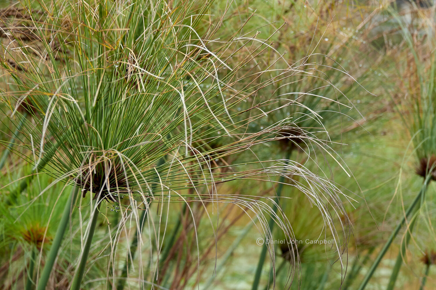
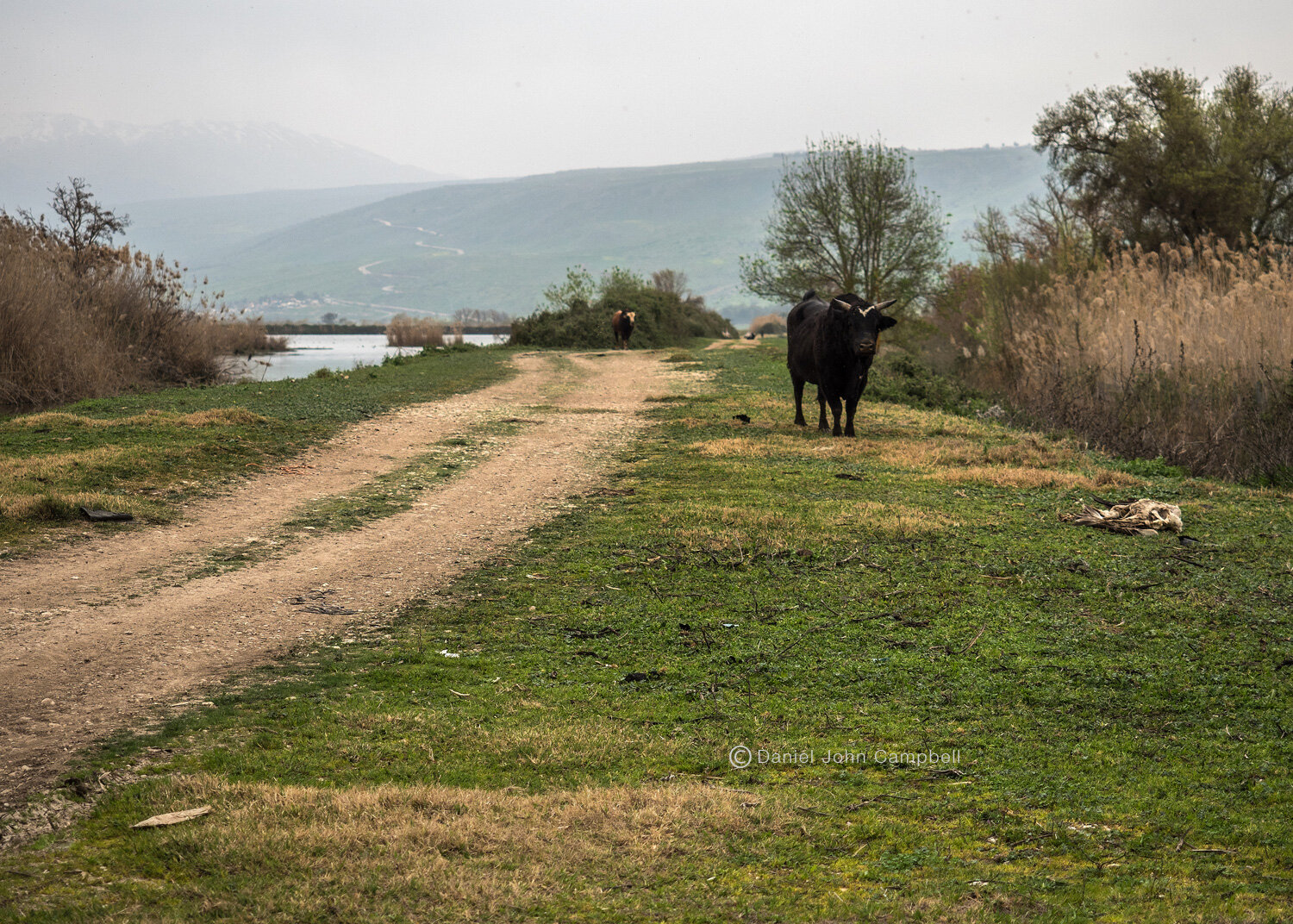
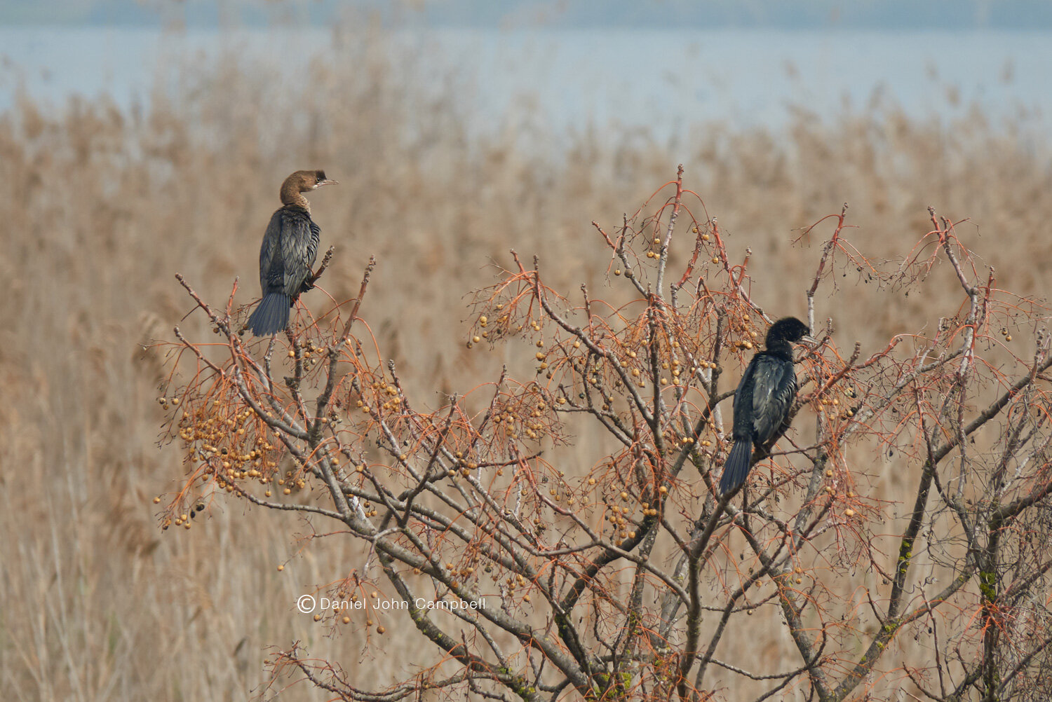
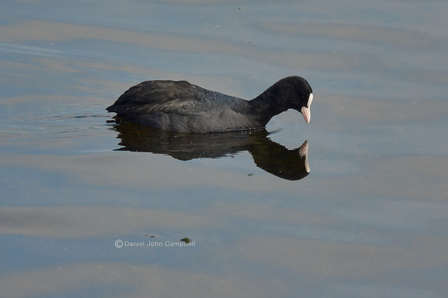
Hula Nature Reserve, Israel
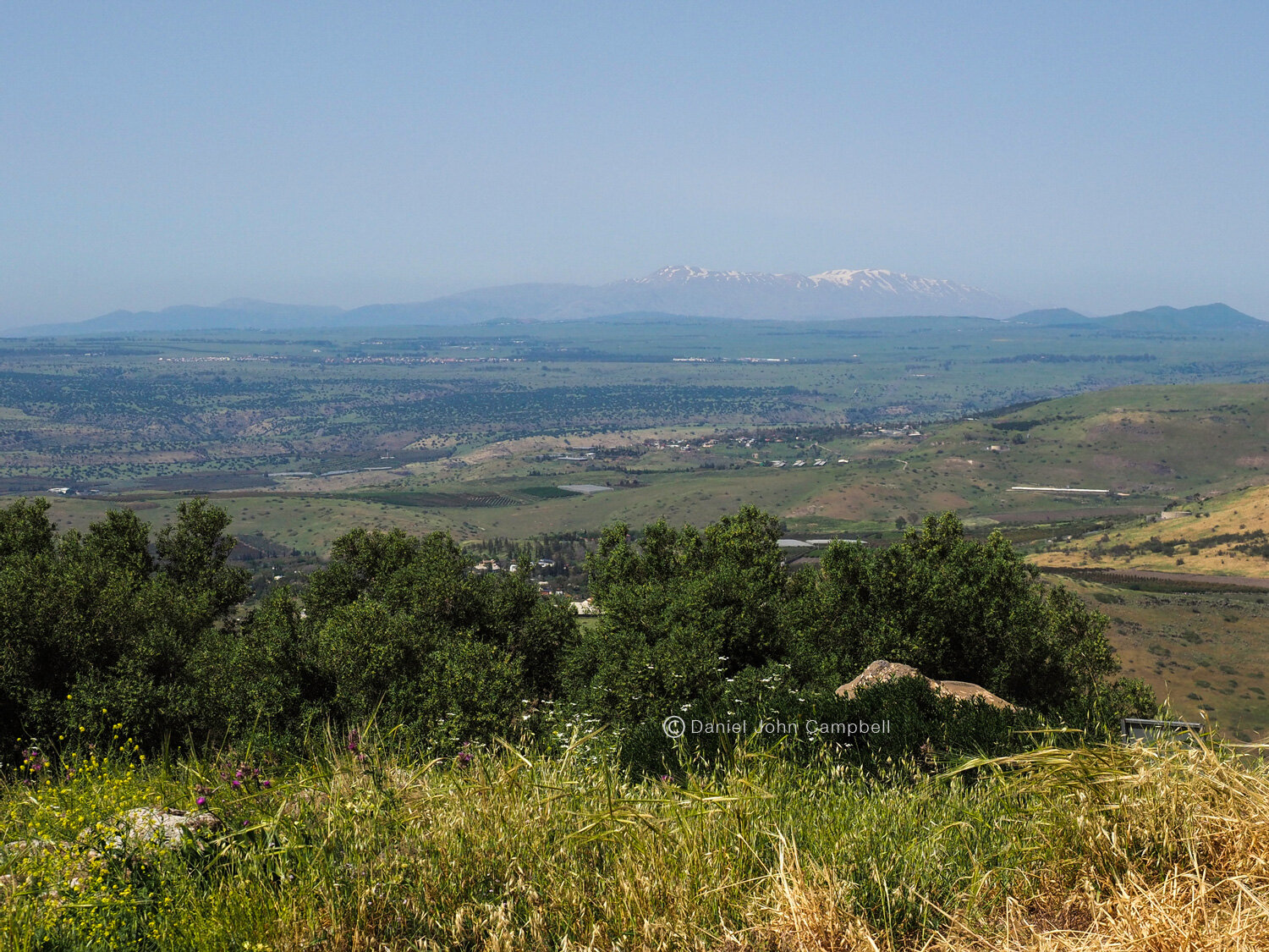
Above Lake Kinnereset (Sea of Galilee) is a lesser known example of Israel’s unique combination of geographical diversity, history and natural beauty . The Hula Basin is framed on the west by the Galilean hills and to the east side by the cliffs of the Golan Plateau. Looking to the North East the dramatic snow capped Mount Hermon rises to an elevation of over 9000 ft. and on a clear day it can be seen from throughout northern Israel. Hermon represents the southern end of the Anti Lebanon mountain range.
With ancient Israel’s conquest of the Canaanites the Hula valley came into the possession of the tribe of Naphtali to the west of the Jordan River, the tribe of Manasseh on the east and the tribe of Dan up north. In the time of Christ most of Hula Basin was in the territory of Ituraea and Trachonitius under the administration of Philip the Tetrarch, one of the sons of Herod the Great. Towards the end of Jesus life, taking a break from the huge crowds that followed him in Galilee, he took his apostles on a walking journey through this beautiful country to teach and prepare them for violent death he was to soon suffer in Jerusalem (Luke 9:22).
Hula Nature Reserve
Pelicans, Hula Nature Reserve, Israel
Hula Nature Reserve
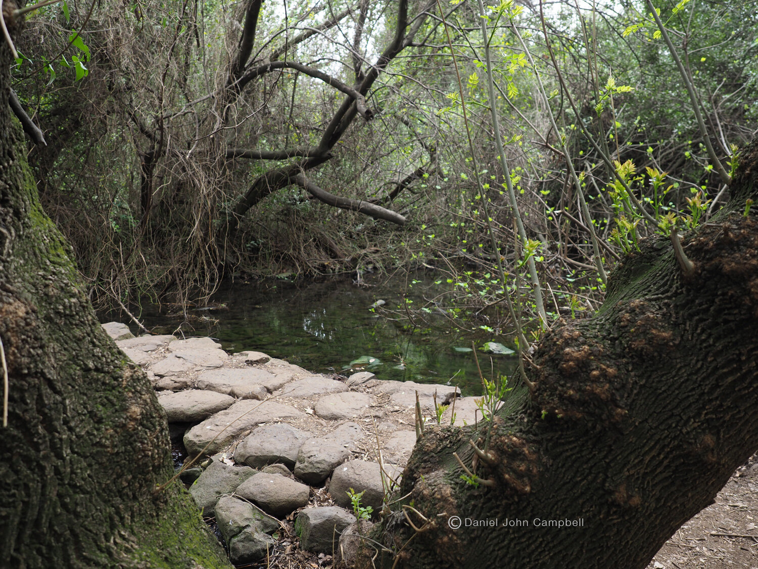
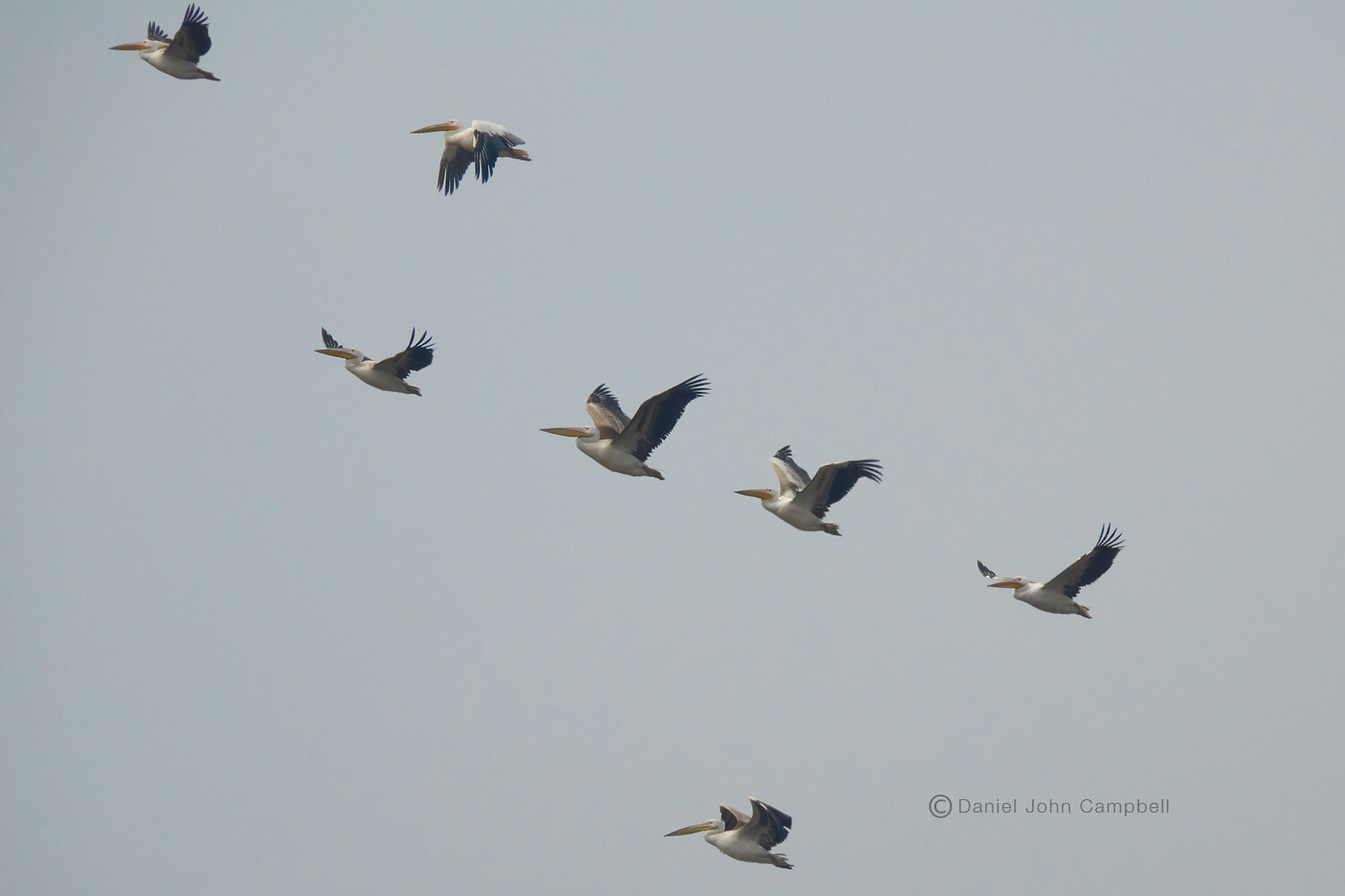
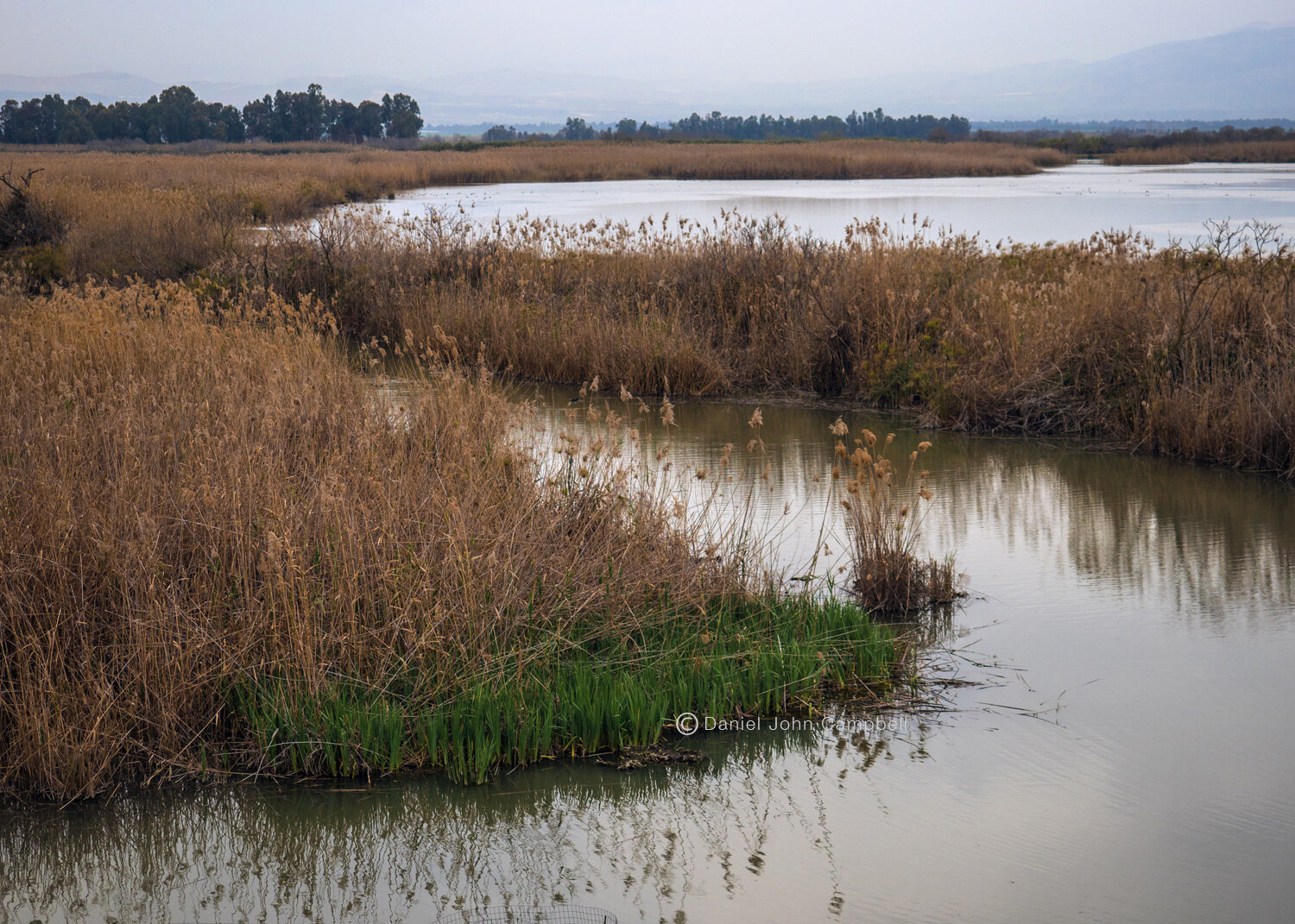
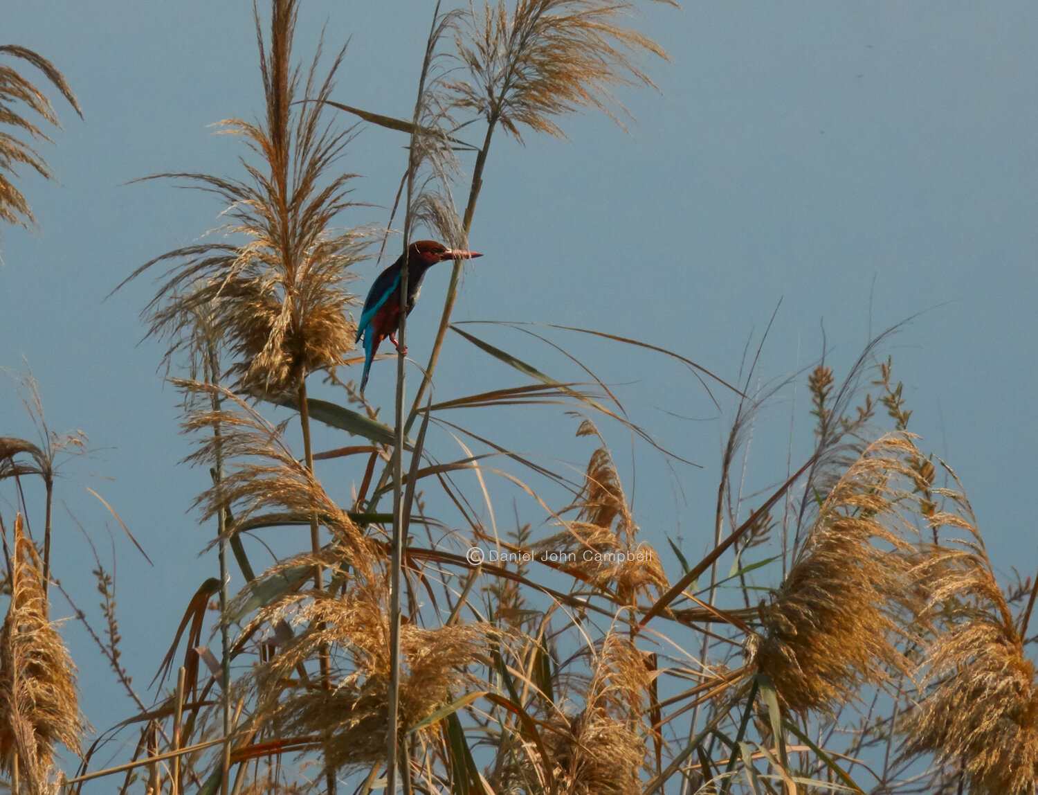
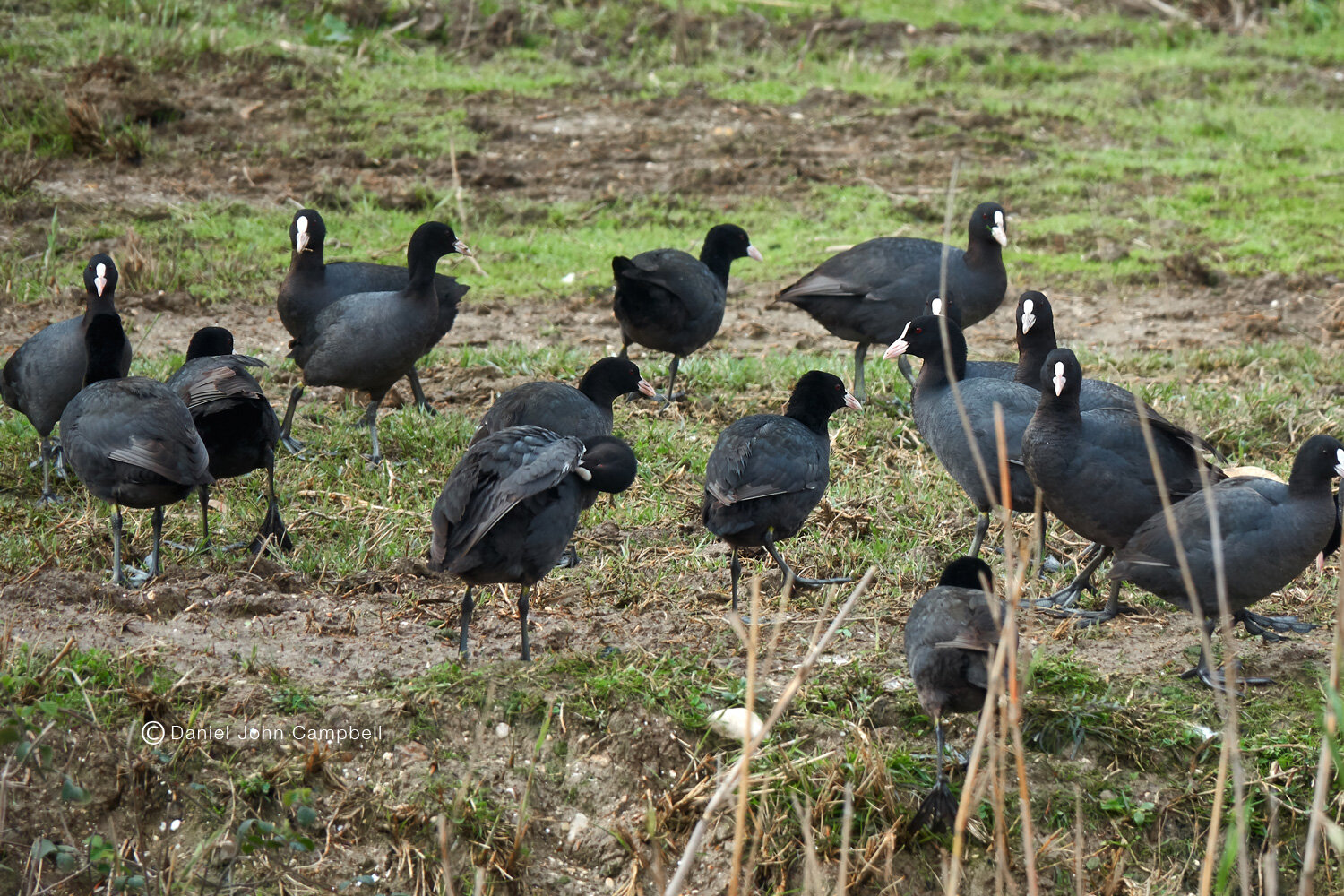
Traveling north from Bethsaida and Korazim east of highway 90 is the Hula Nature Reserve. The Jordan river fed Hula Lake but was drained in the 1950’s to eradicate malaria and to convert the land for farming. Soon after Israel’s first nature reserve was established and the valley has since been partially re-flooded to reintroduce some of the former ecosystem. Today hundreds of millions of birds pass through the valley on their annual migration route between Europe and Africa, and animals such as wild boars, otters, water buffaloes and swamp lynx are repopulating the reserve giving a glimpse of the landscape and wildlife of ancient times.

Hula Nature Reserve, Israel

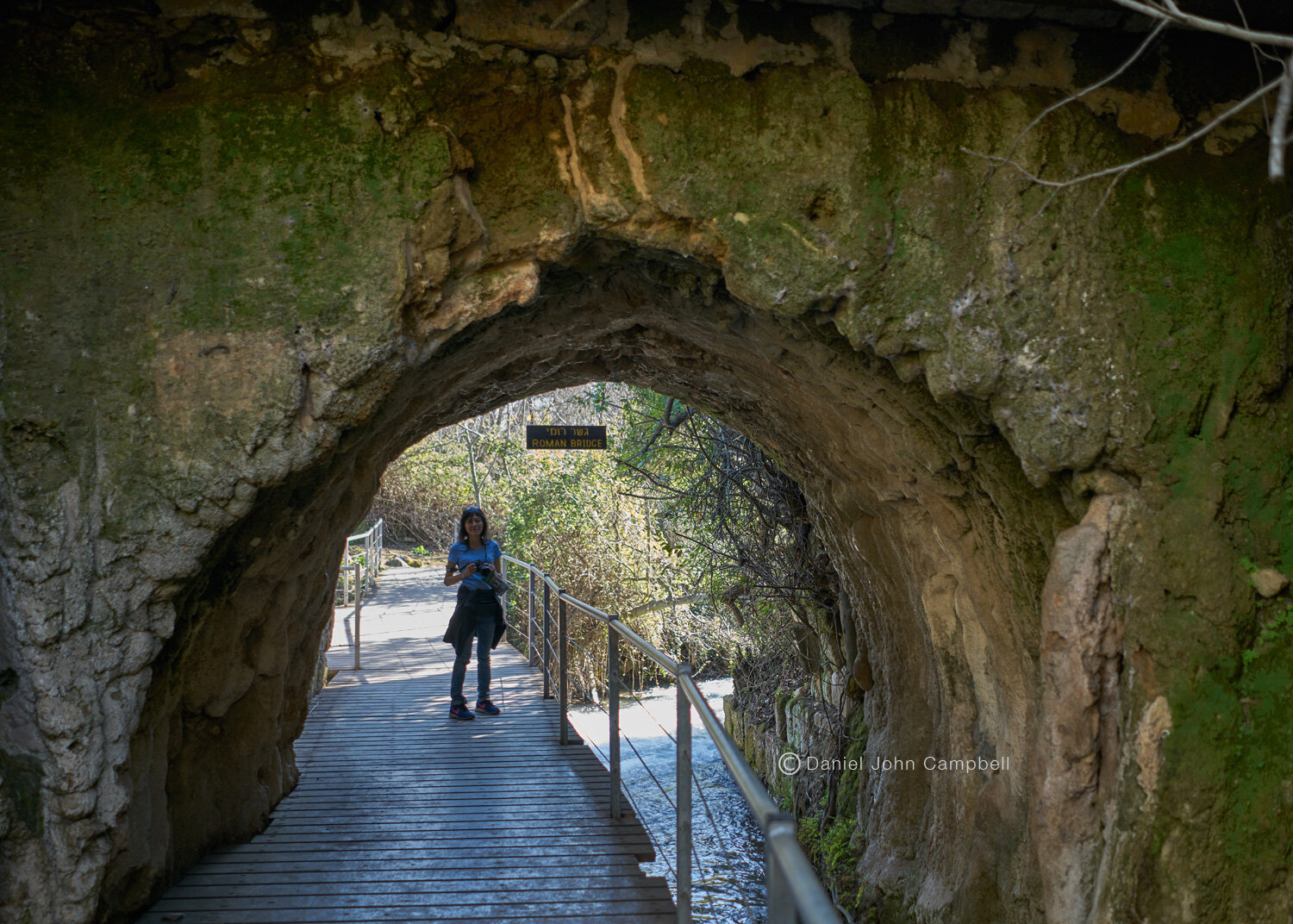
Banyas (Caesarea Philippi)
Banyas (Caesarea Philippi)
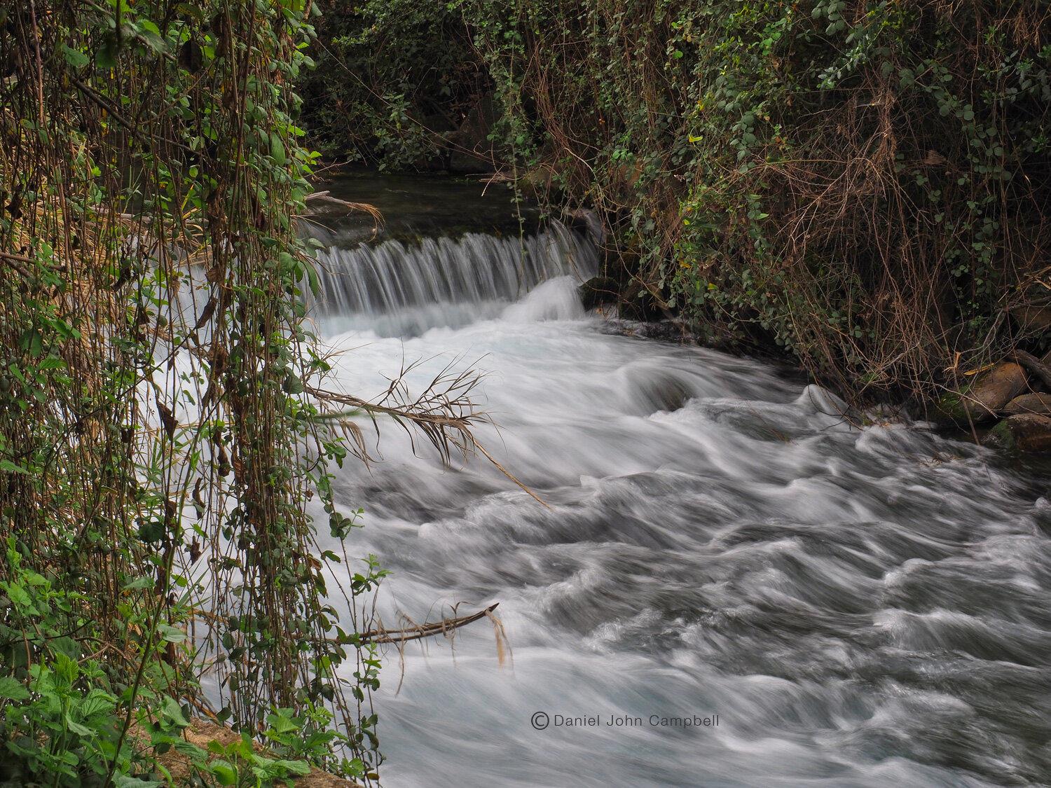
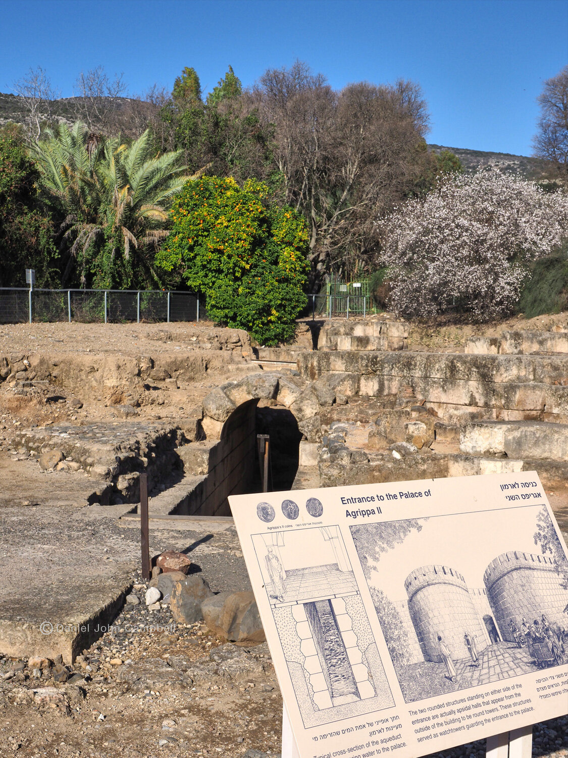
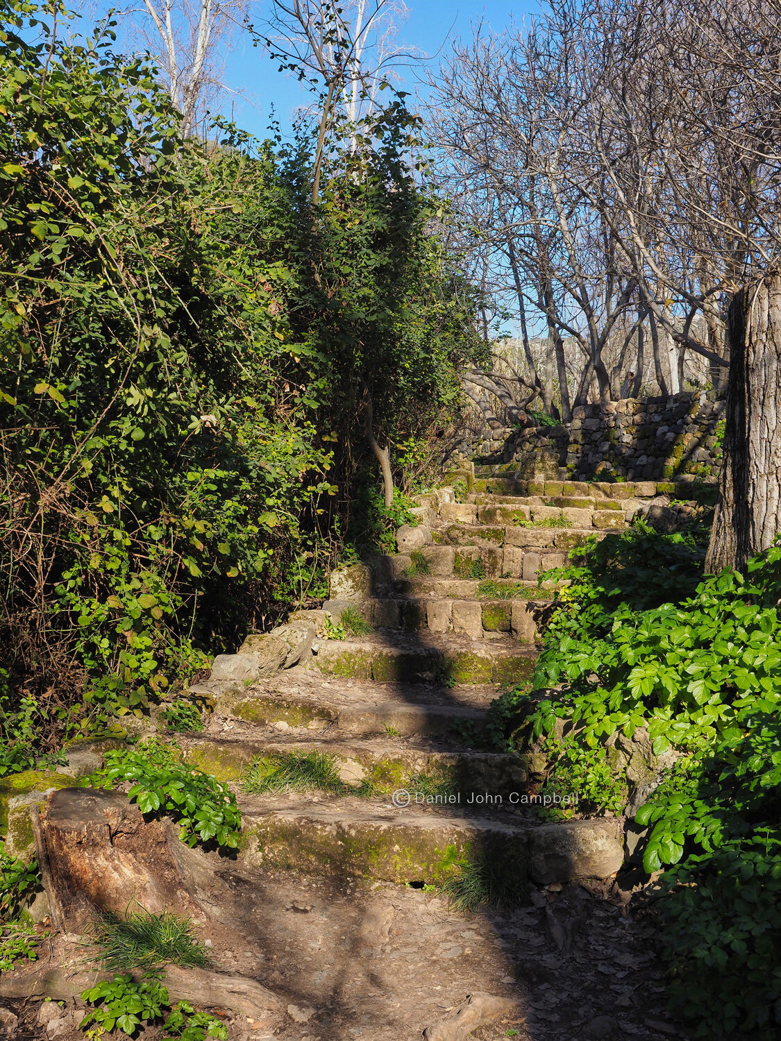
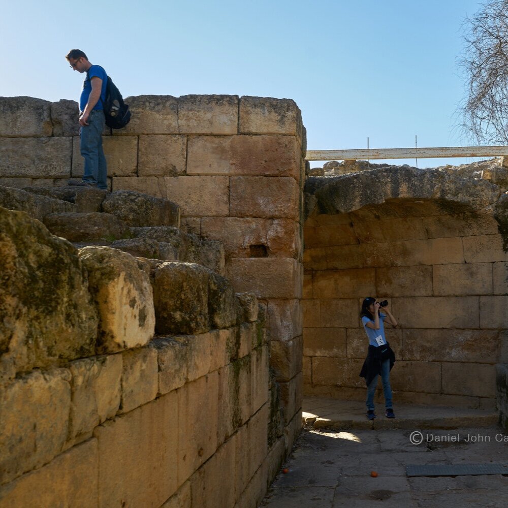
The ruins of Banyas, (Paneus) or Caesarea Philippi as it was known in Roman Times, are found at the foothills of Mount Hermon. The grotto at Banyas is one of the three main sources of the Jordan River, the other two primary streams being the Nahr el-Leddan (Dan river), and the Nahr Hasbani (Senir Stream). The setting is one of the prettiest in Israel with mountains, plains, streams and waterfalls. The area dates back to Canaanite times, and the town became known to history when as Josephus describes “(King) Antiochius (III) overcame (General) Scopas, in a battle fought at the fountains of Jordan”. The Greeks established the ritual of sacrificing at the cave that the Jordan river was thought to originate from in worship to Pan the pagan god of fertility, who the town was named after. When the town came under Roman rule in the first century B.C.E. Caesar Augustus gave control of the city to Herod the Great who in turn built a white marble temple to Augustus. After Herod’s death his son Philip enlarged the city and changed the name to Caesaria - Philippi in honor of Caesar Tiberius. Herod Agrippa II, the Herod who would hear Paul’s testimony in Caesarea (Ac 26:1) before his imprisonment in Rome, would enlarge the city again and build his new palace there. According to the Gospels Jesus taught and performed a miracle around Caesaria - Philippi (Ma 16:13-24, Lu 9:37-42). There is a lovely walk by waterfalls and rapids that are part of the headwaters of the Jordan close by the ruins of the temple of Pan, the ruins of the Roman town and Agrippa II’s palace.

Temple of Pan, Banyas, Northern Israel Photo courtesy of Russell Reid

Temple of Pan, Banyas, Israel Photo courtesy of Russell Reid

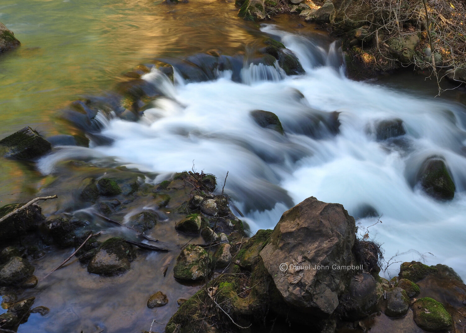
Banias Waterfall, Herman Stream Nature Reserve, Israel
Mount Hermon

Mount Hermon
Mount Hermon
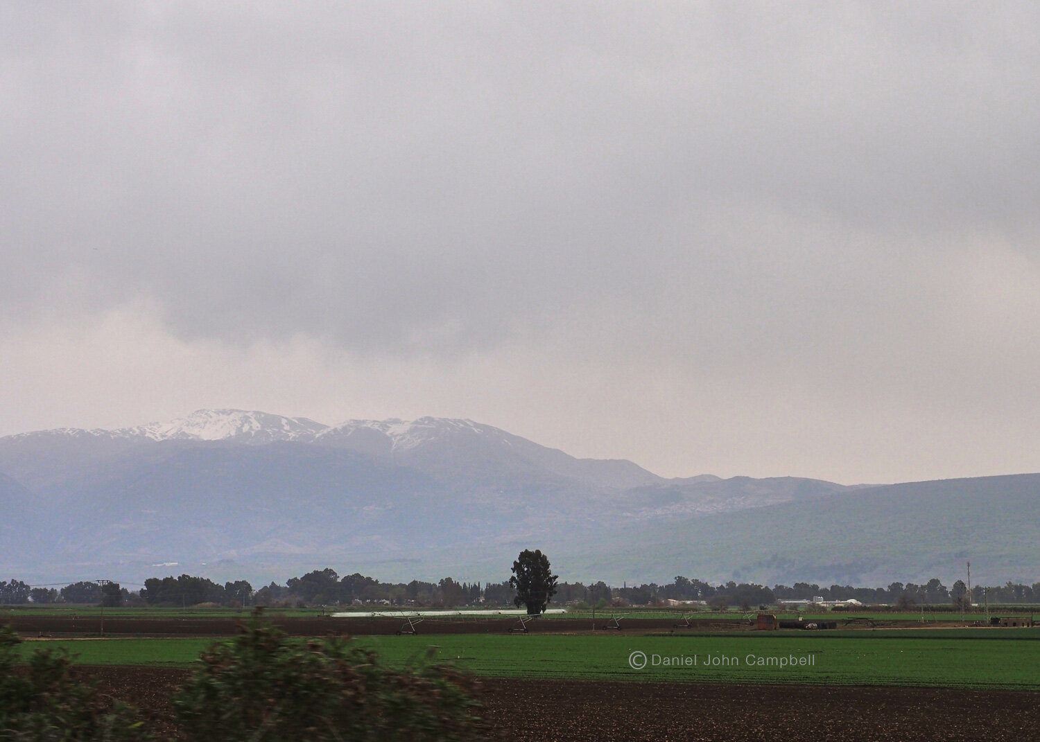
Following highway 99 and taking the 98 junction to Majdal Shams will ascend to the Mount Hermon ski hill parking lot and a chance to experience snow in the Middle East and memorable views of the Hula Valley, Sea of Galilee and the Lebanon mountains. In Bible history Mount Hermon represented the northeast tip of ancient Israel (Jos. 12:1). The melting snows provide most of the waters of the Jordan river and the snow capped peak contrasts with heat of the valley resulting in the strong morning dew on it slopes keeping the plants and trees green, even in the hot, dry summer months. That dew was spoken of poetically in Psalm 133:3. One of the ridges of Mount Hermon may have been the location of Jesus transfiguration (Mt 17:1-9) after his journey to nearby Caesarea Philippi with his Apostles Peter, John and James.
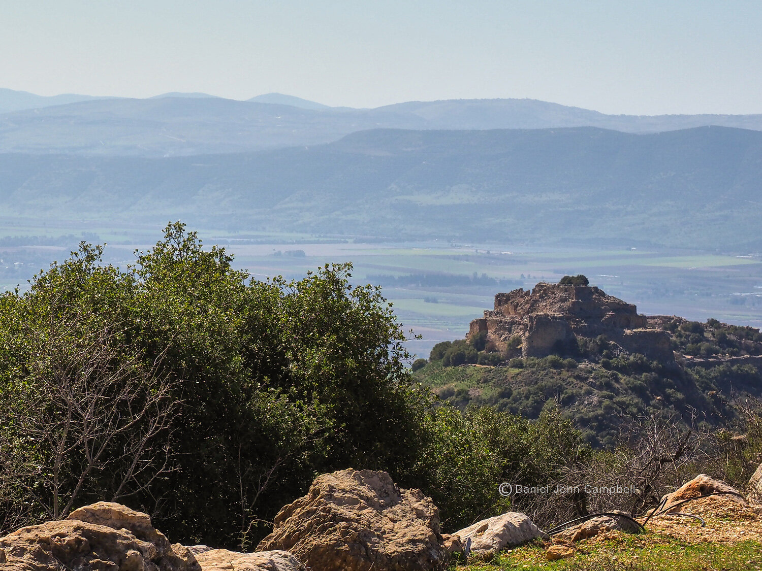
Nimrod’s Castle
Nimrod’s Castle
The descent from Hermon passes by the impressive Nimrod’s Castle overlooking the Hula Valley. The Fortress once controlled the road from Tyre on the Mediterranean to Damascus. In the 12th Century the fortress came temporary under control of the Crusaders, the structure we see today was built by al Aziz, the son of Saladin, to protect Damascus from the 6th crusade. It was conquered by the Mongols, conquered again by the Mamluks and further expanded. When the Crusader era ended at the end of the 13th century it lost it’s strategic use and was eventually abandoned.
Nimrod’s Fortress, Golan
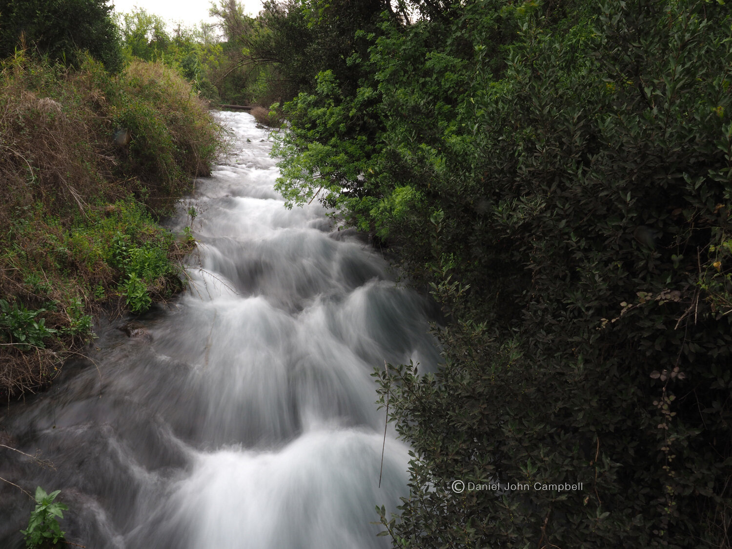
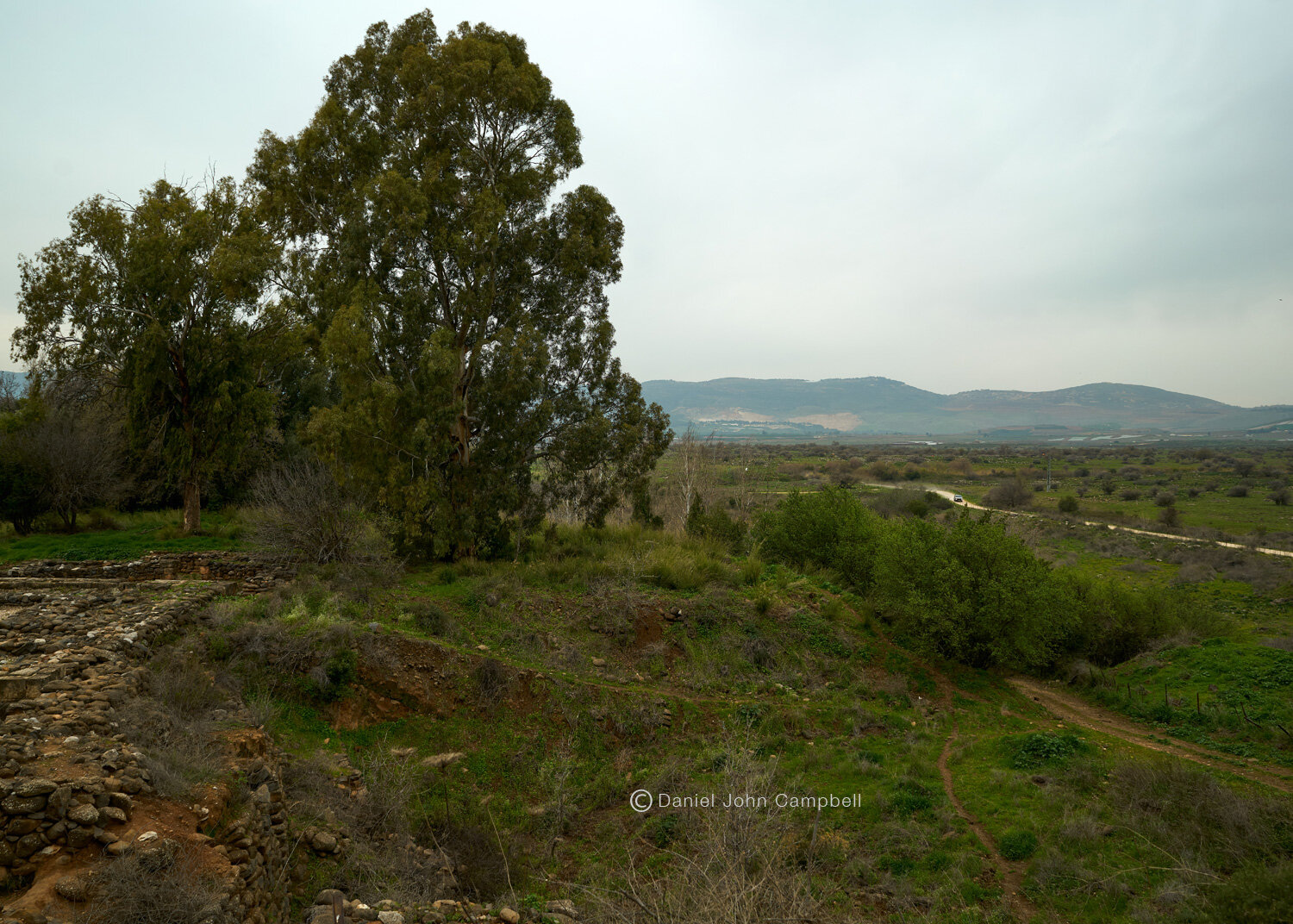
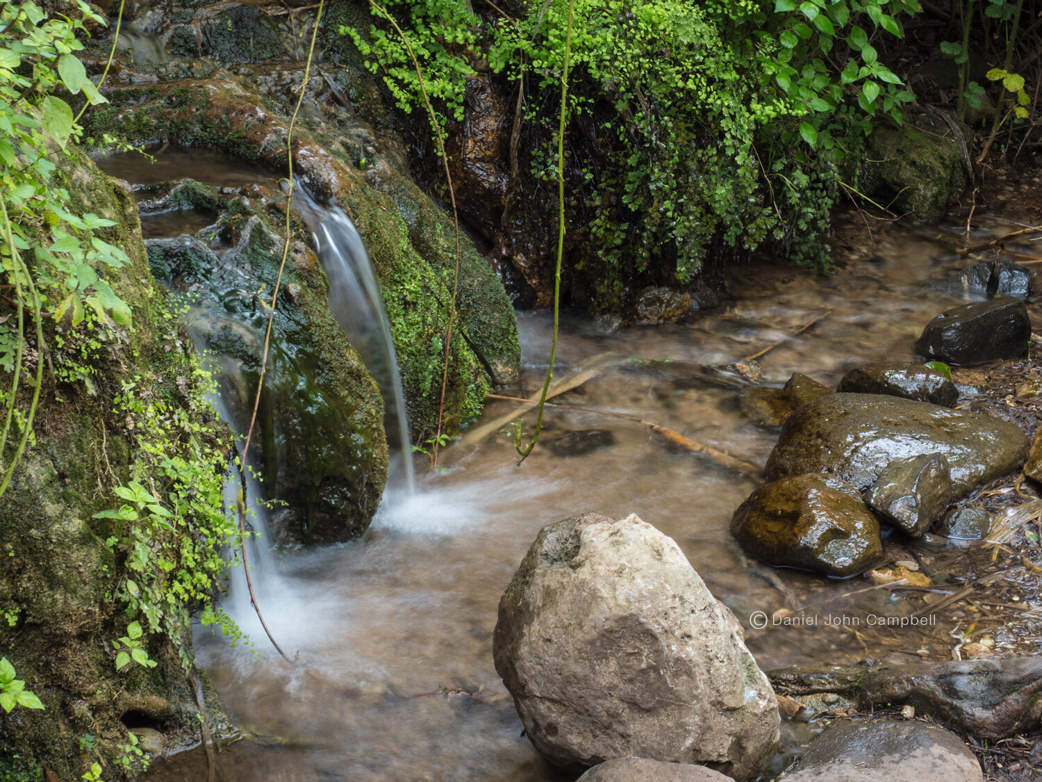
Tel Dan

Tel Dan National Park, Israel
Tel Dan
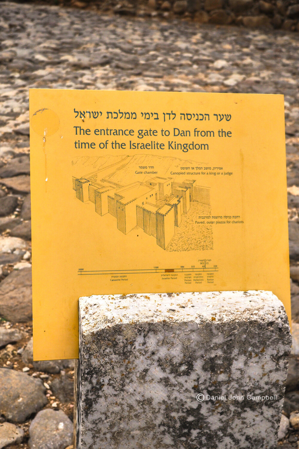
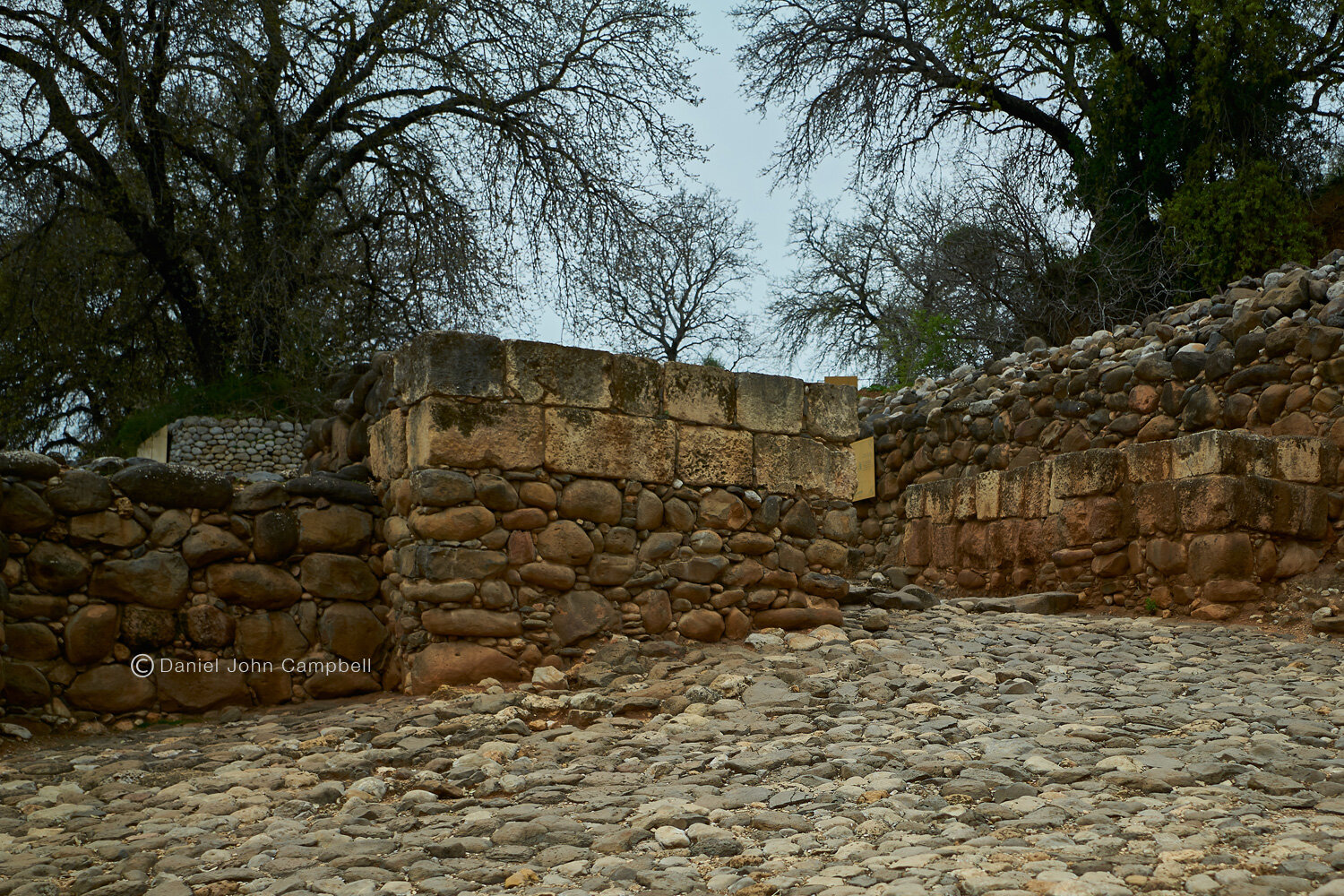
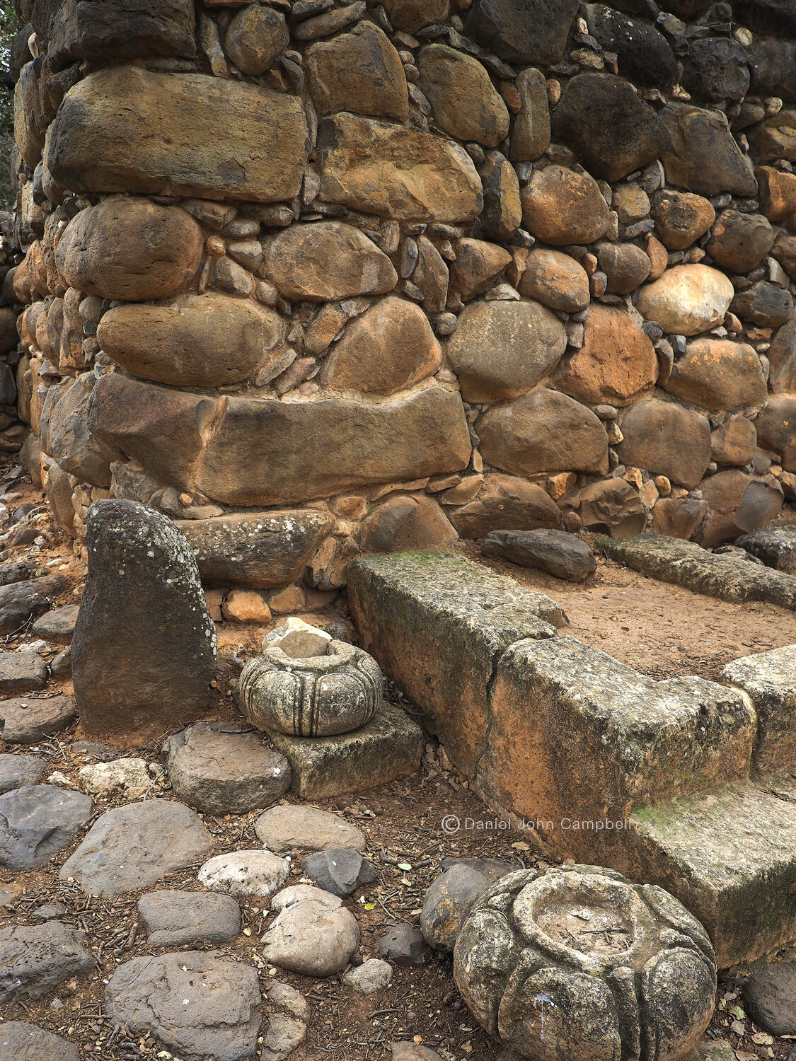
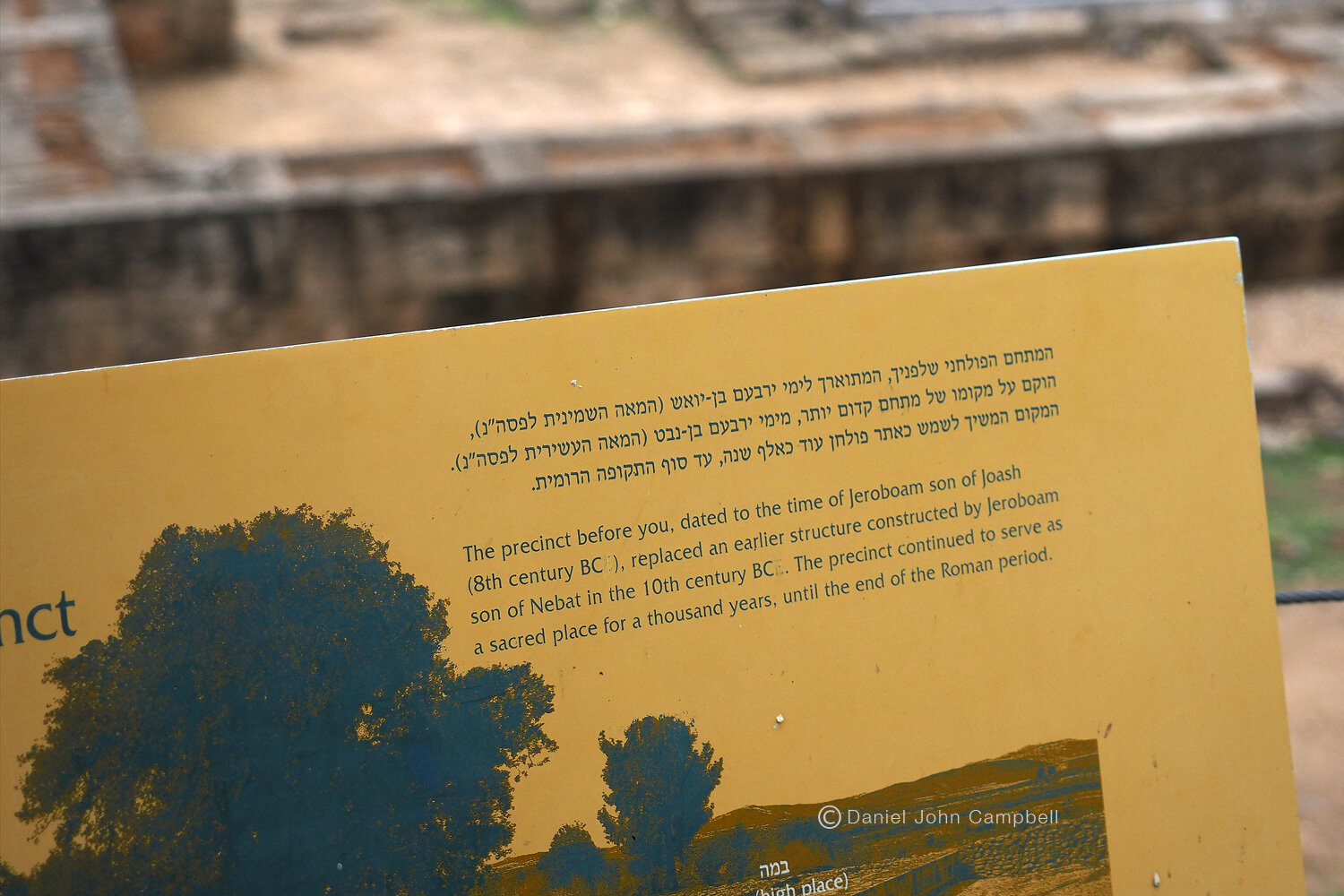
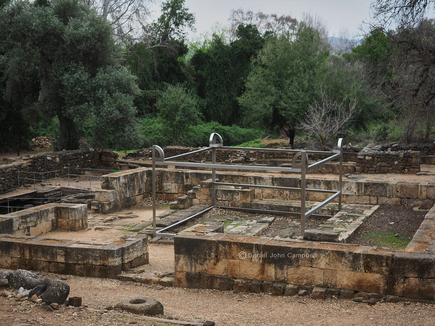
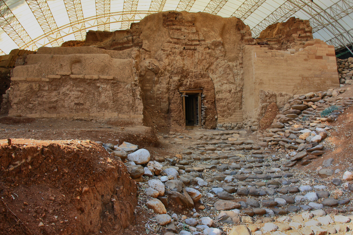
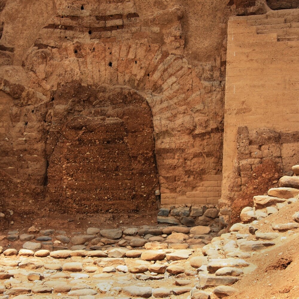
Passing by Banyas heading west there is another important historical site: Tel Dan. The largest tributary of the Jordan river forms from here: Nahr el-Leddanis. There is an enchanting walk through pools and lush vegetation. Like the other later settlements in the area this was a strategic spot, high over the Hula Basin overlooking the important Damascus trade route. In Canaanite times it was known as Leshem or Laish (Jos. 19:47). When it was conquered by the Israelites, and rebuilt by the Danites, it became known as Dan and became a synonymous with the northern boundary of ancient Israel (Jg 20:1). After Solomon, when Israel became divided, King Jeroboam of the Northern Kingdom set up his rival worship to Jerusalem in Dan (1 Ki 12:26-31). Tel Dan’s extensive ruins include rebuilt city walls and gates of Canaan and ancient Israel, one of the earliest examples in history of the arched doorway and the “high places” of golden calf worship established by Jeroboam. Tel Dan is also where Professor Avraham Biram discovered the Tel Dan Stele confirming King David as a historical figure, receiving worldwide attention including front page coverage in the New York Times on August 6, 1993.

Arched Doorway of Canaanite entrance, Tel Dan, Israel Photo Courtesy of Russell Reid

Israelite Gate to Dan, Tel Dan, Israel Photo courtesy of Russell Reid